![]()
 |
|
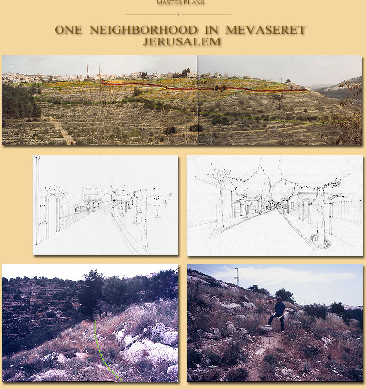
Location: Neighborhood IUD,
Mevaseret, Jerusalem My task was to prepare a set of building codes that would establish the layout of the streets, the size and boundaries of the plots, the location of the built areas on each plot, the size and height of the houses, and the types of building materials. Here an attempt was made to propose a dynamic planning
process that would establish abstract common planning rules
(instead of a fixed plan) relating to the structure of the neighborhood
as a whole, the structure of each plot and the house itself, so that
like in traditional villages, although the houses might look different,
and so will the neighborhood as a whole, they will
“speak” the same language. Along the topographic lines, a main boulevard was drawn which bisected the neighborhood. Intersecting with it were the secondary roads that led the pedestrians from inside the neighborhood to the forest along its boundaries. The route of the boulevard and the smaller paths was established while walking through the area, attempting to follow the paths that had been trodden by the villagers prior to our arrival. The exact location of the built area on the plot and
the location of the outdoor spaces were determined on the basis of very
definite criteria: allowing the southern sun to penetrate the house
through the garden, leaving open spaces exposed to the scenery and
allocating the part of the site where the incline was relatively
moderate for the gardens. The boundaries of each plot stemmed from the layout
of the building and were drawn accordingly. |


